


Koh Hong, Krabi
Anchorage Review: Koh Hong South, Krabi, Thailand
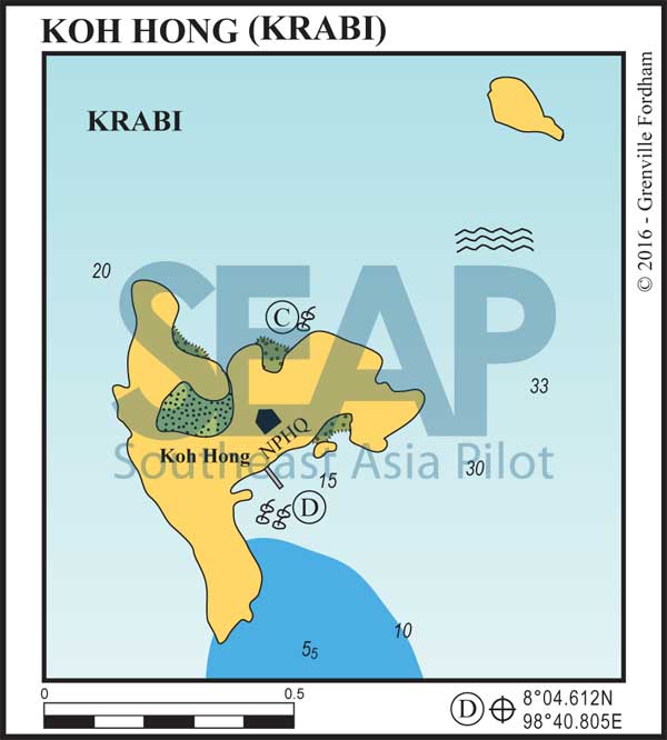
08°04.612N, 98°40.805E – anchorage D on the Koh Hong chart
Mooring buoys
Where a suitable mooring is available at Koh Hong South, use it in preference to anchoring near coral. Moorings can change condition without warning and some are intended only for small, light craft. The skipper remains responsible for checking the tackle, depth, swinging room and suitability for the yacht, and should be ready to move if requested by a park ranger, the mooring owner or another authority.
Overview
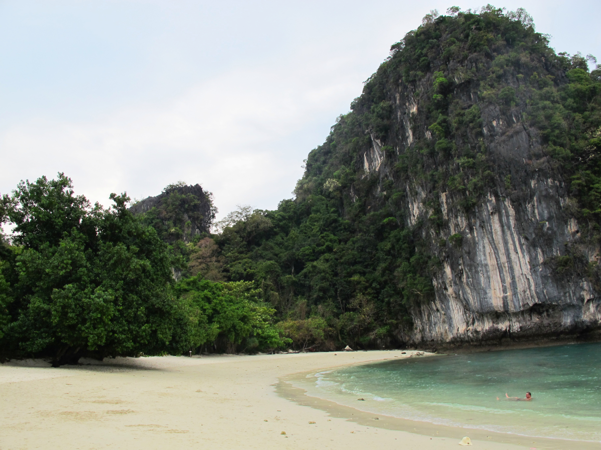
Koh Hong South lies about 11 nautical miles from Ao Nang, among the limestone islands off the Krabi coast. The southern bay combines a striking white-sand beach with steep forested cliffs and clear water, making it one of the most attractive stops in the area. It is also a busy national-park destination by day, but the mood changes once the tour boats begin to leave.
Anchoring
The anchorage is at 08°04.612N, 98°40.805E, marked D on the Southeast Asia Pilot chart. Anchor in approximately 15–20m, or pick up a mooring if one is available and suitable for your yacht and draft. The bay is a useful overnight stop during the northeast monsoon but is exposed in the southwest monsoon.
Make the final approach in good light, keep a careful watch for the fringing reef and allow for the movement of longtails and speedboats serving the beach. Confirm depths and swinging room independently, and do not rely on the sketch chart as a substitute for official hydrographic charts and normal pilotage practice.
Facilities
A floating jetty gives dinghy access to the beach at all states of the tide, and a national-park ranger station is ashore. Facilities are aimed at daytime visitors rather than cruising yachts. Do not count on fuel, water, repairs, waste disposal or serious provisioning here; arrive self-sufficient.
Koh Hong forms part of Than Bok Khorani National Park and visitor fees apply ashore. The Tourism Authority of Thailand currently lists 300 baht for a foreign adult and 100 baht for a foreign child, but park charges and arrangements can change. Check the current park information before visiting and carry Thai baht.
Eating & drinking ashore
A small restaurant normally operates by the beach during the day. It may open for an evening meal if asked before sunset, although hours and services should never be assumed. The safer plan is to arrive with everything needed for the night and treat a meal ashore as a welcome extra.
Highlights
The beach is the immediate attraction: pale sand, clear water and enormous limestone formations that provide welcome shade. Swimming and snorkelling are the obvious pleasures when conditions allow, while the island’s lagoon and viewpoint reward a daytime visit. The ranger station can advise on access and any local restrictions.
Timing makes a marked difference. Day-trip traffic can be heavy, so early morning and late afternoon usually show Koh Hong at its best. For an overnight yacht, the quieter hours after the excursion boats depart are part of the appeal.
Why we like it
Koh Hong South offers the combination cruisers hope to find in Krabi: a workable fair-season anchorage, a memorable limestone setting and an inviting beach within easy reach of the mainland cruising grounds. Come prepared for daytime activity and limited services, then enjoy the relative calm when the bay empties towards evening.
Southeast Asia Pilot
Detailed anchorage charts and pilotage notes for more than 600 anchorages are included in Southeast Asia Pilot. Order your print or eBook copy here.
Southeast Asia Pilot and Phuket Publicity Services do their best to ensure that the information on this website is accurate. However, good seamanship demands that seafarers check critical information carefully with relevant sources to ensure it is up to date.


