North of the Malaysian border, the first main Thai ports in the Gulf of Thailand are Narathiwat and Pattani, both commercial fishing harbours. Not usually on the itinerary of cruising yachts, they can be entered through well-buoyed channels.
Most yachts cruising into the Gulf from the south go straight for Koh Samui, and this is permissible if no landfall is made.
The well heads and rigs of the gas fields in Thai waters are well offshore and unlikely to be encountered unless heading on a more northerly course direct for Pattaya, but anyway are a blaze of light at night.
The weather patterns are similar to the Andaman Sea coast of Thailand, except that the southwest monsoon is dryer in the lee of the peninsula. There’s only one high tide per day in the Gulf of Thailand.
The 100 miles of coastline from the border to Songkhla is well charted in Thai charts 206 and 230, so is not covered in detail here.
A stopover in Songkhla is a good opportunity to explore southern Thailand; the west coast is only 90 kilometres by road. Koh Samui, Koh Phangan and surrounding islands are the first point of real interest for cruising yachts. Busy Koh Samui is the main centre of the group.
To the north are Chumpon, Prachuab Khirikhan and Petchaburi, all large fishing ports serving the huge Thai fleet trawling the Gulf. At the head of the Gulf are the low marshy areas just south of Bangkok and the mouth of the Chao Phraya River, gateway to Thailand’s Central Plain and much of the country’s rich history.
The port of Songkhla lies at the mouth of an inland waterway and is the best first point of entry into Thai waters. A large commercial port at the mouth of the river services the supply vessels for the offshore rigs to the east.
A vibrant town, it’s the administrative centre for the province of Songkhla, although Hadyai, just 20 km inland, is a larger city as it straddles the main railway between Bangkok and Singapore.
Hadyai is a border town with direct flights to Bangkok, Singapore, Kuala Lumpur and Phuket. Many visitors from Malaysia flock to Hadyai for the cheap shopping and nightlife.
North of Songkhla, the coast up to Nakhon Sri Thammarat is a long uninteresting stretch of beach backed by prawn farms. There’s nothing of note for cruising vessels and most continue up to the Samui islands after leaving Songkhla.
Narathiwat
6°26.048N, 101°49.562E
A quiet provincial fishing town in Thailand’s deep south, Narathiwat – 60 miles north of Pulau Perhentian Besar – makes for a pleasant ‘real Thailand’ stopover en route to Koh Samui, and a chance to do some provisioning at the local markets and/or the Big C Supercenter just 3 km from the anchorage.
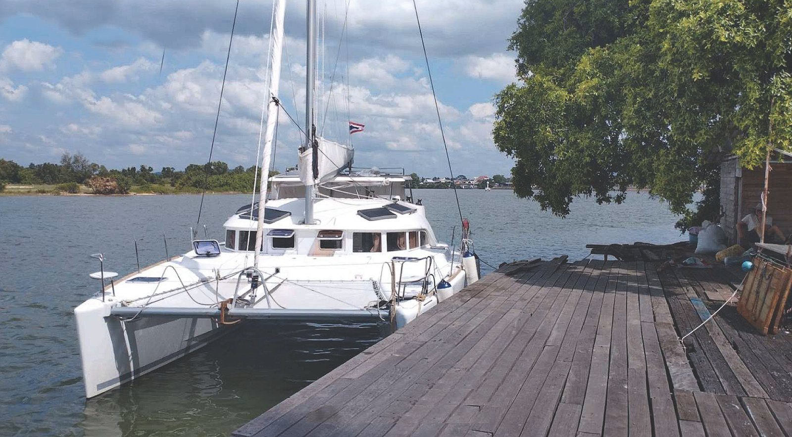
The entrance to the Bang Nara River is at 6°27.135N, 101°49.962E. Note the depth at the entrance is about 2 metres at low tide. Once through the entrance, head towards the town to our anchorage at the Ocean Blue Mansion, which has a jetty available to private yachts by advance arrangement; the owner has proven to be very helpful. If you feel like a night or two ashore, rooms at this fairly new budget hotel are in the 350–450 baht range.
People here rarely see a foreign pleasure boat, so you’ll find plenty of curious onlookers. They may include government officials – but they are unlikely to bother you in their official capacity.
While in Narathiwat, check out the riverside Rim Khuean Market, an 800-metre walk south of the anchorage, for a wide variety of southern Thai food.
Ocean Blue Mansion: +66 (0) 73-511047 & +66 (0) 73-511109
Amelie, alongside the Ocean Blue Mansion jetty in the Bang Nara River, Narathiwat | Photo by Elliot Lyons.
Surat Thani & Donsak Pier
The city of Surat Thani is the capital of the province of the same name and means ‘City of the Good’. The main town is nestled close to the coast facing northeast at the mouth of the Ta Pi River. The city fringes the huge bay of Ao Ban Don which is shallow, lacklustre and uninviting.
Ferries to Koh Samui, Koh Phangan and the Ang Thong National Park islands depart from the town jetty in the river and eastern provincial centre of Don Sak, 22 km by road northeast of the city.
There are Immigration offices in town and on Koh Samui for yachts checking into Thailand. Donsak is the main car and passenger departure point. There are two ferry operators – Seatran and Raja – each with its own jetty, while Lomparayh operates speedboats to the islands. Pleasure and private yachts need to make advance arrangements to use the jetty.
Anchorage can be found virtually anywhere along the coast in 5–10 metres; a very small town adjoins the ferry terminals, where you can find supplies.
Further south on the mainland is the town of Khanom. A broad river giving access to shipyards and commercial fishing wharves runs north-south into the town. Two miles south is a four-mile-long, east-facing pristine beach with numerous bungalows and mid-range resorts. Anchorage can be found anywhere off this beach in the southwest season.
Koh Samui, Koh Phangan & Ang Thong Archipelago
This section covers the area bounded by Koh Tao, the Ang Thong National Park group, Koh Phangan, Koh Samui to the east and Chumpon to the northwest.
Generally speaking, the islands lie in a shallow part of the Gulf of Thailand, off the east coast of the southern peninsula where the waters are rather turbid, with poor visibility for snorkelling.
Koh Tao and the islands adjacent to Chumphon are a notable exception, with Koh Tao in particular offering clear waters and the best diving in the western Gulf.
Koh Samui, Koh Phangan and Koh Tao are major tourist destinations and are accessible by ferry or speedboat from the mainland. Koh Samui also has a private airport with connections to Bangkok, Phuket, Pattaya and regional destinations. Bangkok Airways, Thai Airways and Singapore Airlines fly into Samui.
Monsoon wind patterns are the same as for the rest of the country. However, from May until October, during the southwest monsoon, the seas are calmer than the Andaman due to the protection of the Malay Peninsula, and there is less rainfall. In fact, Koh Samui enjoys some of its finest days during the months of July to September.
Conversely, during Phuket’s fine but windy weather from November to February, Samui is lashed by strong northeast monsoon storms, and the seas can be rough. The South China Sea is influenced by the Pacific Ocean, and most of the year there will be only one high tide per day, as compared to the Andaman Sea, which has two tides daily.
Technical support for cruising and charter vessels is still limited. However, some charter and day trip activity operates from Bo Phut and there are several jetties at Bangrak. Good workshops and hardware stores are found in the towns of Nathon (on Samui), Surat Thani, Chumphon and Nakorn Sri Thammarat (on the mainland). A marina for Koh Samui has been discussed for more than a decade. It certainly needs one.
Note that this website may not reflect the most recent updates to the printed book and the eBook. While every effort has been made to ensure that the information contained in this book is accurate, the charts of anchorages are based on personal experience and satellite imagery and are intended as a guide only. They should not be used for navigation. Please refer to Official Hydrographic Charts of the respective countries.