


Mukut Village, Tioman
Anchorage Review: Mukut Village, Tioman, Malaysia
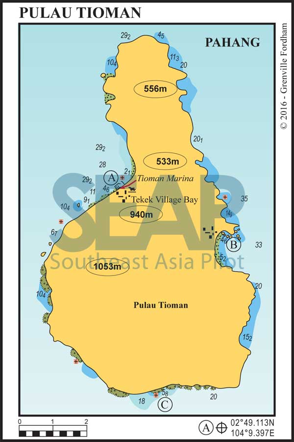
02°43.129N, 104°11.688E – anchorage C on the Tioman Island chart
Mooring buoys
Do not assume that any local mooring off Mukut is suitable for an overnight yacht. Moorings can change condition without warning and may be intended for small local craft. If one is offered, the skipper remains responsible for checking the tackle, depth, swinging room and suitability for the yacht. Otherwise, anchor on sand as described below, keeping clear of the fringing reef.
Overview
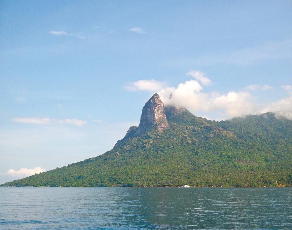
Mukut is a small kampong on the southern side of Tioman, set beneath the twin granite pinnacles of Gunung Semukut. These summits are known locally as the Dragon Horns and are also sometimes called the Donkey’s Ears. The village gives cruising yachts a quieter alternative to Tioman’s busier arrival points, with a dramatic mountain backdrop, simple shore access and useful walking close at hand.
Anchoring
The anchorage is at 02°43.129N, 104°11.688E, marked C on the Southeast Asia Pilot chart. Anchor in approximately 8–15m on sand in front of the village.
Make the final approach in good light so that the edge of the fringing reef and any small craft can be seen clearly. Check the forecast, swell, depth and swinging room before settling for the night. Confirm the yacht’s position independently, and do not use the sketch chart as a substitute for official hydrographic charts and normal pilotage practice.
Facilities
A concrete jetty serves Mukut and gives convenient dinghy access. The Southeast Asia Pilot notes that water is available there, while smaller vessels may be able to approach the jetty at high tide. Check the depth and local advice before bringing a yacht alongside.
Services ashore are modest. There are basic resorts and village shops in the area, but crews should not rely on finding fuel, repairs, waste disposal or comprehensive provisioning. Arrive self-sufficient and ask locally before making plans around any particular service.
Eating & drinking ashore
Mukut and the small resorts along this stretch of coast offer simple places to eat, although choice and opening hours can vary with the season and visitor numbers. Ask in the village after landing and keep a meal aboard as the dependable fallback.
Highlights
The easiest excursion is the short walk to Asah waterfall, also known as the South Pacific waterfall. The trail begins near Mukut and reaches the falls in about ten minutes, making it a practical shore trip without committing the whole day.
The Dragon Horns dominate every view from the anchorage. They are a recognised rock-climbing objective, but the serious routes are for properly equipped and experienced climbers rather than a casual walk from the beach. For most crews, the pleasure is in exploring the village paths, visiting the waterfall and looking back towards the yacht beneath one of Tioman’s most distinctive skylines.
Why we like it
Mukut feels connected to the island rather than built around visiting yachts. The sand-bottom anchorage, friendly kampong and nearby waterfall make a satisfying stop in their own right, while the great granite horns above the village give the place a character that is unmistakably southern Tioman.
Southeast Asia Pilot
Detailed anchorage charts and pilotage notes for more than 600 anchorages are included in Southeast Asia Pilot. Order your print or eBook copy of Southeast Asia Pilot.
Malaysia photo gallery
Follow Southeast Asia Pilot on Facebook
Southeast Asia Pilot and Phuket Publicity Services do their best to ensure that the information on this website is accurate. However, good seamanship demands that seafarers check critical information carefully with relevant sources to ensure it is up to date.


