This website uses cookies to improve your experience. We believe you'll be OK with this, but you can opt-out if you wish. Or you can go to 'cookie settings' and choose which cookies to allow. Privacy policy

The main island of Phi Phi Don is geologically two islands. A sandspit joins them together
Click to view Krabi & Phi Phi gallery.
FacebookLinkedInInstagram
26 miles from Ao Chalong, Phuket


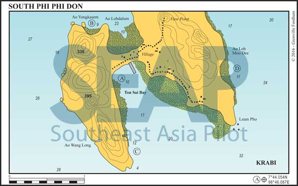
Ton Sai Bay is secure in both seasons. The anchorage is at the head of the bay, on the west side. This avoids the regular longtail boat and ferry traffic heading for the jetty on the east side. Don’t attempt to approach the jetty if you value your topsides.
Entering the bay, it’s wise to keep to the west since the water is deep and the coral clearly visible. On the Admiralty and Thai charts there is drying rock, shown as lying just to the east of the southwest headland forming the bay. It does not exist. It is a shallow patch about 4 metres deep at extreme low tide. The best anchorage is on sand in about 10-12 metres. This is close enough to the fringing reef to be able to swim from the boat.

The rebuilt Ton Sai village is at the east end of the narrow sand isthmus connecting Phi Phi Don’s two lobes. Bungalows and restaurants extend along the bay’s northeastern side almost to the headland. There’s a new concrete promenade all the way along the beach, so the only place for your dinghy is at the water pier in front of the hospital, towards the western end of the beach. High tide depth at the fresh water pontoon is 2.8 metres.
If approaching to fill your water tanks keep your fenders down very low and approach bow to the beach. It can get really busy with day-tripper boats filling up so be patient. It can cost up to 1,000 baht per cubic metre.
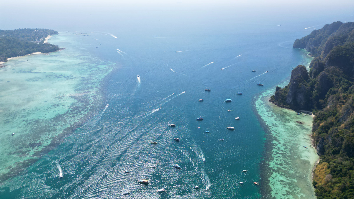
Said to be one of the three most beautiful islands in the world, Phi Phi Don is not as idyllic as it once was. The development and the huge numbers of day trippers make the island anchorages very crowded most of the time.
It’s not easy to find swinging room amongst the permanent moorings; dive boats that come and go at all hours. Don’t pick up a mooring! They’re all ‘private’ (even if they look like government buoys) and incidents of aggressive behaviour have been reported. Best to arrive around end of daylight hours and anchor away from the private moorings.
It’s still the best spot in the region for a great night ashore. Use a bright torch for night dinghy rides as floating lines abound and there are hordes of unlit longtails and speedboats. They can neither see nor hear you. Best to send a shore party in early morning to raid the bakeries and ice factory so you can get out before it gets chaotic.
Dive schools operate from the beach, and there are lots of opportunities for excursions in longtail boats to the most spectacular hongs and inlets, which are found on both islands. Ton Sai Bay is where to anchor if you want the night life ashore.
5 miles from Ton Sai Bay, Phi Phi Island


Just west of Ao Lohdalum is the smaller, jungle-fringed, Ao Yongkasem with an anchorage outside the seaward edge of the coral in 15 metres.
This bay is an ideal overnight stop at any time of the year. It can be used in preference to Ao Lohdalum, for more peace and tranquillity. Both Lohdalum and Yongkasem now have plenty of government moorings. So, after 5pm, most visiting yachts can stay overnight, even in high season.
At the back of Yongkasem beach, lush foliage provides shade for picnics. It is also home to a large tribe of crab-eating macaques. The snorkelling is great. Ao Lohdalum itself also has excellent snorkelling and a wonderful swim-through cave on the west headland. Be hyper-aware when going ashore anywhere on this north side by dinghy that it dries for hundreds of metres at low tide.
Click to view Thailand gallery.

1.5 miles from Ton Sai Bay, Phi Phi Island


Ton Sai West Tip is great for a lunchtime dive or beach picnic. Anchor in 12 metres close to the small sandy beach fringed with coral that nestles into a deep recess in the cliffs. There’s a small palm-fringed indentation with a white sand beach a few hundred metres north, towards Ton Sai beach on the western edge.
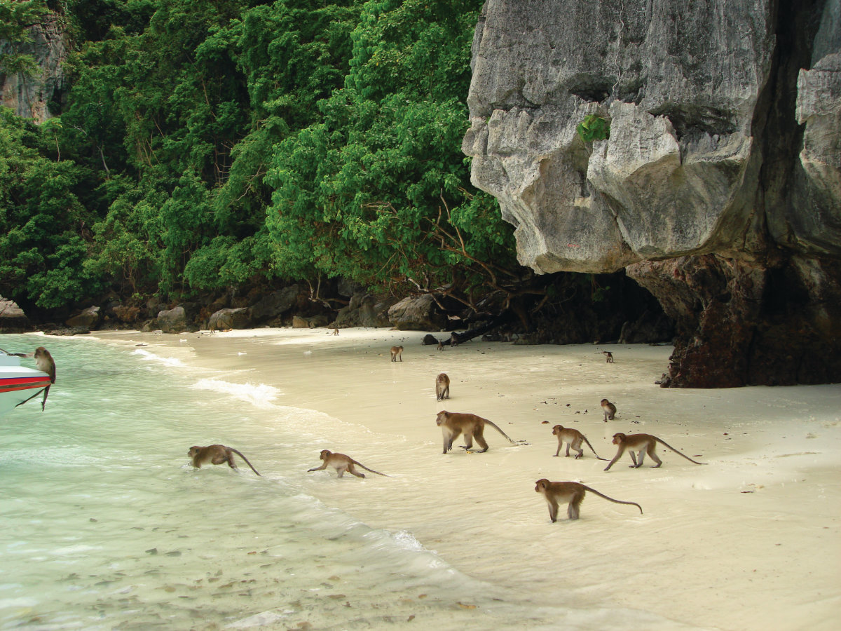
The locals now call it Monkey Beach. It used to be one of the best places in the world for a picnic. However, now brazen wild monkeys have overrun the beach; they will steal your lunch. As the number of day visitors has increased, it’s become its own tourist attraction. Speedboats drop in at high tide to feed the mischievous troop ashore.

3 miles from Ton Sai Bay, Phi Phi Island


At Ao Loh Moo Dee, in the southwest monsoon season, you’ll find a reasonable anchorage in 11 metres off a sandy beach. Enjoy some nice snorkelling and a restful night without the crowds.
Click to view Thailand gallery.
FacebookLinkedInInstagram