This website uses cookies to improve your experience. We believe you'll be OK with this, but you can opt-out if you wish. Or you can go to 'cookie settings' and choose which cookies to allow. Privacy policy
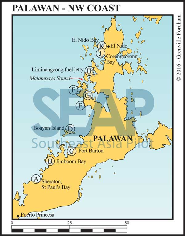
Primarily a diving destination, cruising is possible year-round, although the northeast monsoon season provides more anchorages and stable weather patterns. Water clarity is best between December and March. While Puerto Princesa is the official port of entry, it is possible to organise officials to visit your boat on the west coast anchorages of Fish Bay, Quezon and El Nido.
The 80 miles running from Saint Paul’s bay on the west coast opposite Puerto Princesa to El Nido in the north offers some of the best cruising, with picturesque bays and typhoon-proof anchorages.
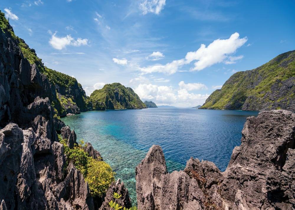
This entire coast is relatively undeveloped but, with the expansion of tourism infrastructure, road and airline links are improving. For the cruising yacht, basic needs can be met in most destinations and this area is unlikely to see the mass influx of major brand hotels and resorts for several years.
The bays on this coast offer a mixture of karst scenery, pristine beaches, national parks and great diving and snorkelling. Tidal range in this area is seldom more than 1 metre. The southwest of Palawan has a number of poorly-charted reefs; approaching from the southwest give them plenty of sea room.
With Palawan being below the usual typhoon track, the area is one of the safest cruising grounds in the Philippines.
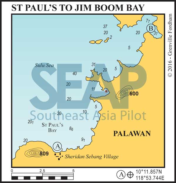


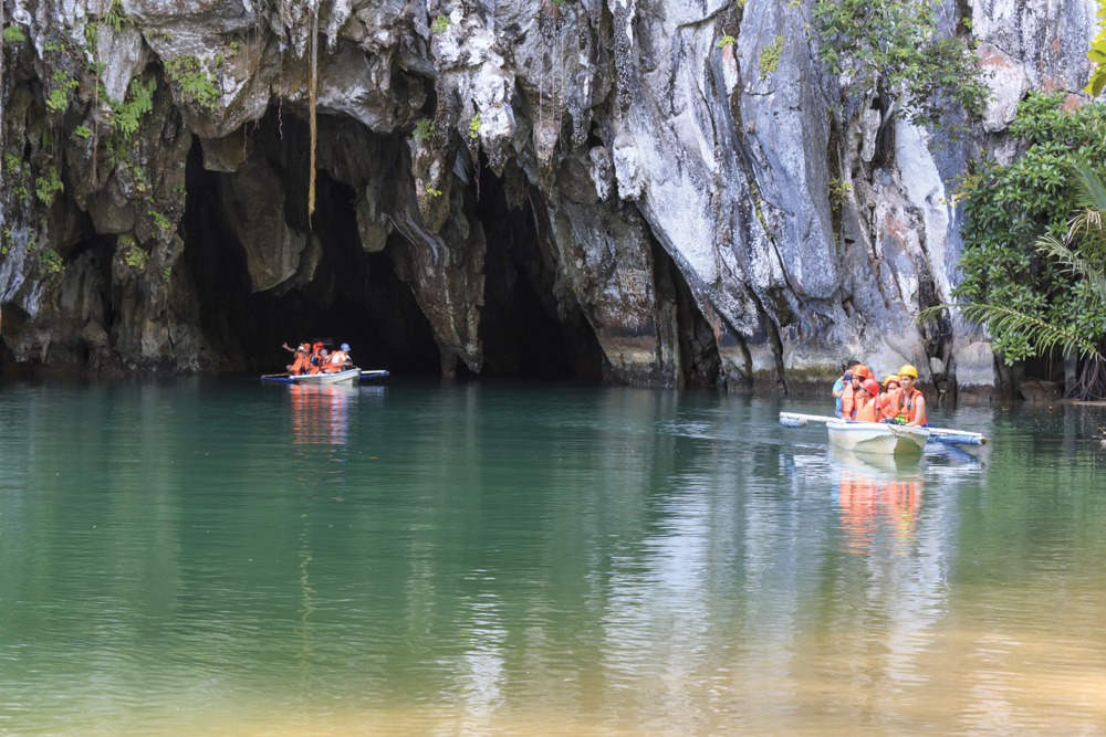
Anchor in 5-10 metres in this north-facing bay. As well as several resorts and shops ashore, this is the main staging area for trips to the Subterranean River with ‘banca boats’ full of tourists coming and going. The cave tour takes 2-3 hours and is well worth the experience.
There are road links to Puerto Princesa and it takes about two hours by jeepney. To the west of Sebang boat pier is a beach-front waterfall where jerry cans can be filled. In northerly winds the swell here can be uncomfortable.
13 miles from Sebang Village


This bay is very protected and has good holding in sand in 5-7 metres anywhere in the bay. One of the most secluded spots on this coast, dinghy exploration is great on the beaches in the two north bays.
Click to view Philippines photo gallery.
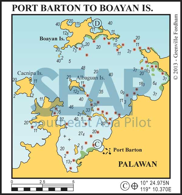
28 miles from Sebang Village


The cruising north and east of Jimboom Bay offers dozens of opportunities for anchorage and exploration.
Approaching Port Barton beware of fish farms at the mouth of the bay. A course of 138°arriving and 318°departing avoids the reefs. Anchor off the village in 3-4 metres on sand, about 150 metres off the beach. Going ashore by dinghy, head for the massive propeller hanging outside the Jambalaya Café.
There is a laundry and Caltex station close by and a water hose on the beach next to the café. Essential provisions are in the village and the Jambalaya Café has great Cajun themed food and the coldest beer in town. The Summer House resort offers free WiFi.
31 miles from Sebang Village


Boayan Island and surrounds offer a dozen decent anchorages in either season. Our spot is in the large protected north-facing hook-shaped bay.
There is a large privately owned house ashore at the eastern end of the bay and good holding is on sand in 10 metres. The many unpopulated islands around here often have a minefield of fishing nets and pots dotted around them. Night sailing is not recommended.
Click to view Philippines photo gallery.

42 miles from Sebang Village


A very dramatic anchorage under the peak of Mt Capoas and also with a sandy beach and a few dwellings ashore. A good photo-op. Can be open to any swell so other options may be preferred.
(a) 45 miles & (b) 49 miles from Sebang Village


This area is protected from the northeast and there are numerous good anchorages to chose from. Here are just two of the many:
(a) White Island. 10°50.56N, 119°14.43E. Anchor in the bay in 5 metres on sand just to the north of White Island.
(b) Cape Ross. 10°56.00N, 119°13.84E. Just to the south of Cape Ross, keeping clear of Bay Rock.
62 miles from Sebang Village


Malampaya Sound is deep, 20 miles long and offers plenty of opportunity to shelter in dozens of well-protected anchorages.
This anchorage is recommended for most conditions. Ashore on the river is the small town of Calapa. Two other recommended hurricane holes are Taitai Bay, 5 miles northwest, where high surrounding hills guarantee calm waters and 8 miles further north, toward Endeavour Passage, is the Pirate’s Hole at 10°56.800N, 119°19.500E .
68 miles from Sebang Village


Endeavour Passage with Tulutan Island on its west side has depths generally greater than 10 metres and offers a route northwards to the ocean. At the north end is the town of Liminangcong which has a concrete dock where you can moor alongside to take fuel.
Click to view Philippines photo gallery.
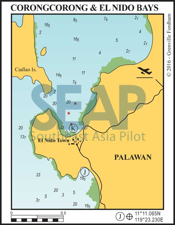
77 miles from Sebang Village


Anchor in 5 metres on sand north of the main town jetty. This is sheltered in the southwest season but a lot busier than Corongcorong Bay due to the tour boat traffic. The rolled gravel airstrip is four miles northeast from town with flights to Manila and Tay Tay.
Click to view Philippines photo gallery.
75 miles from Sebang Village


Anchor in 10 metres in this long sandy bay. It’s a 10-minute walk or a 5 pesos tricycle ride over the isthmus to El Nido town. A great northeast season anchorage with all the amenities you’d expect ashore at the main town.
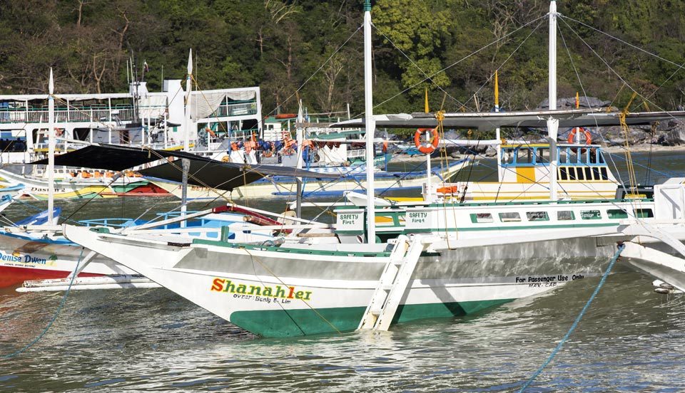
There are boat tours to the lagoons and islands offshore. This may be the best base for exploration since the depths at other locations make anchoring difficult. Notable destinations are Lagen Island, Guntao island to the south and Tapiutan Strait to the north. Daytime anchoring is possible in these locations for diving and snorkelling.
