When following our suggestions on where to anchor, please be aware of any coral in the area. Always pick up a mooring buoy in preference to anchoring if there is one available. While public moorings are mostly a big improvement on ‘the old days’, we strongly advise you to dive and check the condition of any mooring as soon as practical after picking it up.
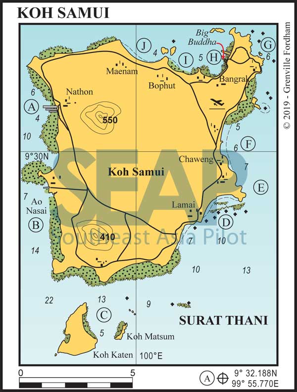
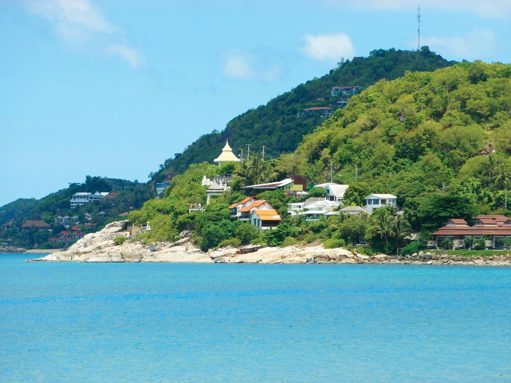
Samui Island is a rare gem. Preserving the idyllic simplicity of a tropical hideaway, it’s characterised by beaches of powdery white sand backed by many hotels and bungalow resorts.
Read more140 miles from Songkhla


Anchor in 7-10 metres well clear of the jetties. Nathon, the main town on the island, offers a market as well as shopping, banking, postal and other facilities. This is also where you go to deal with Customs and Immigration. The main jetty is designed for fast passenger and car ferries, the local fishing fleet and bulk transport. Fuel and water are available on the jetty by arrangement only.
5 miles from Ao Nathon, Samui


This is the location of another car ferry terminal from Donsak, and is not particularly recommended unless you are meeting passengers from the ferry.
11 miles from Ao Nathon, Samui


Approaching from the east beware of the unmarked rocks just past Lamai Beach. Anchor between the islands in 5-6 metres on a muddy bottom, clear of the fringing reef on Koh Katen’s east coast. The approach from the west is clear and deep, following Koh Katen’s north coast.
With a small resort ashore, this is a pleasant and secluded overnight spot or an ideal day destination from the main island. There are trails through the mangroves leading to caves ashore.
Click to view Thailand photo gallery.
On the southwest corner of Samui are five islands where the locals collect bird’s nests. The waters around the islands are deep, so this is not one of our recommended overnight anchorages although day anchorage can be found on the eastern side of Koh Mae Tap.
On the southwest side, shelter can be found from strong winds without dropping the pick. There is a cave that runs right through the island. Koh Bon is great spot for a swim to cool off.
Many small shacks cling to the steep cliff faces and bamboo scaffolding used by the nest collectors can be seen rising to the top of the sheer rocks.
18 miles from Ao Nathon, Samui


The best anchorage is in 6-8 metres on a sandy bottom in the middle of the bay. Take care to avoid the sand and fringe coral outcrops to the northwest of the bay. The anchorage may become uncomfortable in the southwest season due to ground swell.
Ao Lamai is the second-most-developed bay on the island, with plenty of action ashore. Accommodation of all types is available, together with the usual minimarts, bars, discos and restaurants.
21 miles from Ao Nathon, Samui


This small indention in the coast north of the headland makes a nice lunch stop and is used as such by many local fishing boats. Anchor outside the bay in 10 metres on sand, as the inner bay has a rocky bottom.
20 miles from ao Nathon, Samui


The main tourist bay on Samui, Ao Chaweng is separated by a rock formation into two beaches: Chaweng Noi (south) and Chaweng Yai (north). The gradually sloping sandy bottom permits anchorage in 5-10 metres anywhere in the bay. In the southwest season, even in quite strong prevailing westerlies, a ground swell from the east can make this anchorage uncomfortable.
Major hotels, resorts, bungalows, restaurants, shops and discos sprawl along the road behind the beach. The main part of town is at the northern end. Towards the southern end of Chaweng Yai, the red roofs of the Centara Samui Resort can be clearly seen. Transport can be arranged by local bus or taxi from the road behind; Nathon is about 45 minutes away.
Click to view Thailand photo gallery.

15 miles from ao Nathon, Samui


This is a reasonable daytime anchorage, affording access to the resorts ashore, but it is not suitable for overnight stays due to the rocky bottom. anchor in 8-12 metres well clear of the beach.
12 miles from Ao Nathon, Samui


One large bay divided by a rocky promontory forms Bo Phut to the west and Bang Rak to the east. These bays are shallow, only 4 metres up to a mile offshore with anchorages on a sandy bottom in 2-4 metres. They offer the best protection from swell and wind during either season.
Approaching either bay from the northwest, beware of the reef at the western end. Arriving from the east, the passage between Koh Som and the headland has a depth of 4 metres. In the east of the bay are several wooden and concrete jetties operated by tour companies where fuel and water can be arranged.
The best organised, giving all-tide access, is Petcharat Marina, in essence a pier to deep water and a shore-based speedboat operation that can provide some services. At Bo Phut there’s a night market and walking street. The Billabong and the Frog and Gecko are lively pubs offering great food, laundry and car hire services nearby. Refueling larger quantities can be pre-arranged at the nearby PTT service station or by jerry can at the western end of the village.
These north-coast beaches developed more recently than Chaweng and Lamai and are less built up. In Bangrak, look for the huge Buddha on Koh Fan, the island north of Haad Bangrak. This bay is directly on the approach path of the airport, so it can be a little noisy. There’s a large concrete ferry pier in the southwest corner of the bay which is deep enough to go alongside.
Ashore in each bay you’ll find clusters of small resorts and bars and a variety of small shops and local markets along the road. Many restaurants and small resorts line the bay, particularly in Fishermans Village. Further west at Maenam, anchor in 4-6 metres on a sandy bottom. Beware of the submerged rock off Laem Na Rang.
