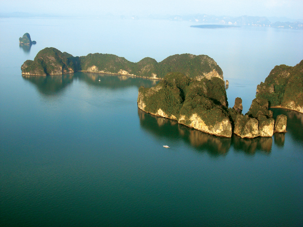
The Hong, (Thai for room) which gives the island its name, is a stunningly beautiful, enclosed pool with a large chimney opening to the sky. Once inside, you will find perfect opportunities for photography, relaxing or exploring.
Entering from the east, spot the dog rock formation on the top of the cliff. A buoyed rope has recently surrounded Hong Island and dinghies are forbidden to enter the main cave.

16 miles from Yacht haven


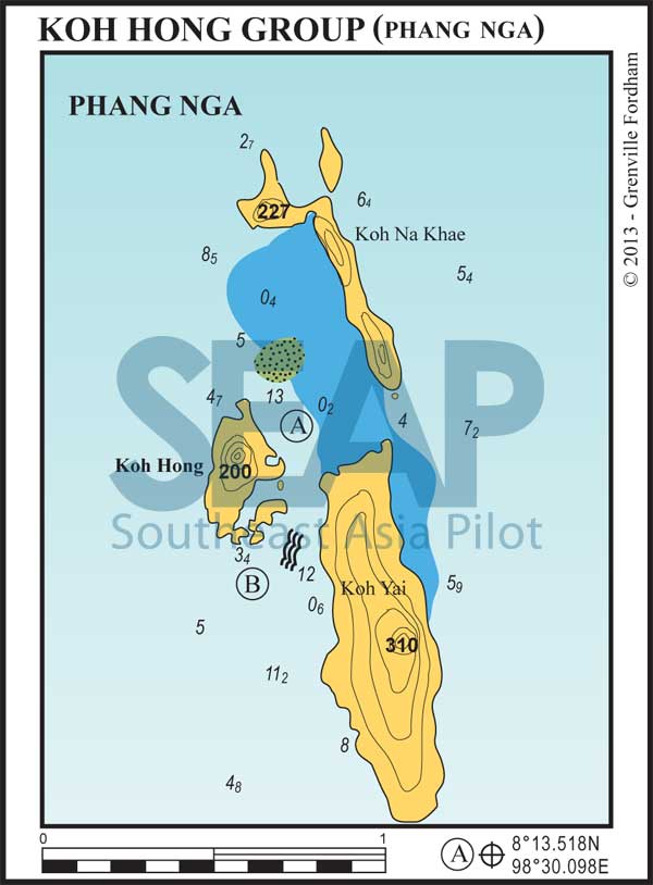
The best anchorage in this group of islands (A) lies between Koh The best anchorage in this group of islands (A) lies between Koh Hong and the shallow water to the west of Koh Na Khae. Suitable for both seasons, this very picturesque anchorage has good holding in approximately 12 metres on a muddy bottom, and gives easy access to explore around Koh Hong by dinghy.
Just south of Koh Hong (B) is another anchorage in 4-5 metres on a muddy bottom, directly outside the small cave that opens into the lagoon. Both these anchorages are very busy with day trips and sea canoe tours coming and going during the day.
If swimming in these channels beware of strong currents, particularly during spring tides. There is a National Park station on Koh Yai and it is likely the ranger will approach and ask for the park entry fee, currently 400 baht per person.
Care ought to be taken, if heading north from this location, to keep well clear of the shallow bank to the west of Koh Na Khae. The passage between Koh Yai and Koh Na Khae is not recommended for any but shoal draft vessels. Yachts proceeding east from this group should pass north around Koh Na Khae or south of Koh Yai.
Click to view Thailand photo gallery.

