This website uses cookies to improve your experience. We believe you'll be OK with this, but you can opt-out if you wish. Or you can go to 'cookie settings' and choose which cookies to allow. Privacy policy

Koh Dam or Koh Poda? It might seem someone is trying to confuse you. L
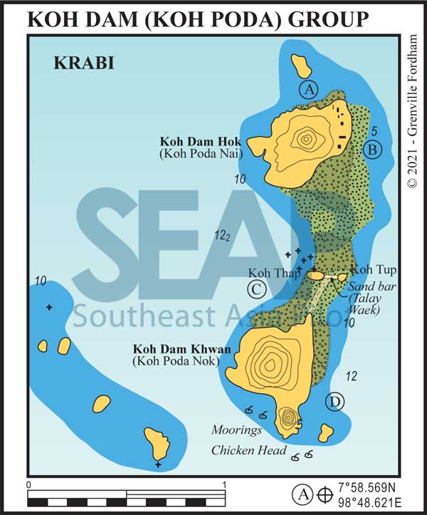
o a Google search and you will get results for both names – but nowhere do they tell you it’s the same place. Well, we have decided to do just that. Koh Dam Hok is Koh Poda Nai and Koh Dam Khwan is Koh Poda Nok.
Confusion over…
All the islands in this group belong to the Hat Noppharat Thara-Mu Ko Phi Phi National Park; at the time of writing, 400 baht per person entry fees are levied on non-Thai visitors.
Click to view Krabi & Phi Phi gallery
FacebookLinkedInInstagram

4 miles from Ao Nang, Krabi


There are government moorings at North Koh Dam Hok in 6 metres.They offer secure overnight anchorage in 12 metres between the main island and the small islet. The bottom is sandy, giving way to coral outcrops towards the beach. On shore casuarinas provide shade to a nice beach and flat sandy ground – fine for cool walks round the island.
A bungalow resort with a restaurant nestles up against the hill. Snorkellers should swim off the north-eastern end of the beach, where there is an area of colourful shallow coral reef.
Click to view Thailand gallery.
FacebookLinkedInInstagram4 miles from Ao Nang, Krabi


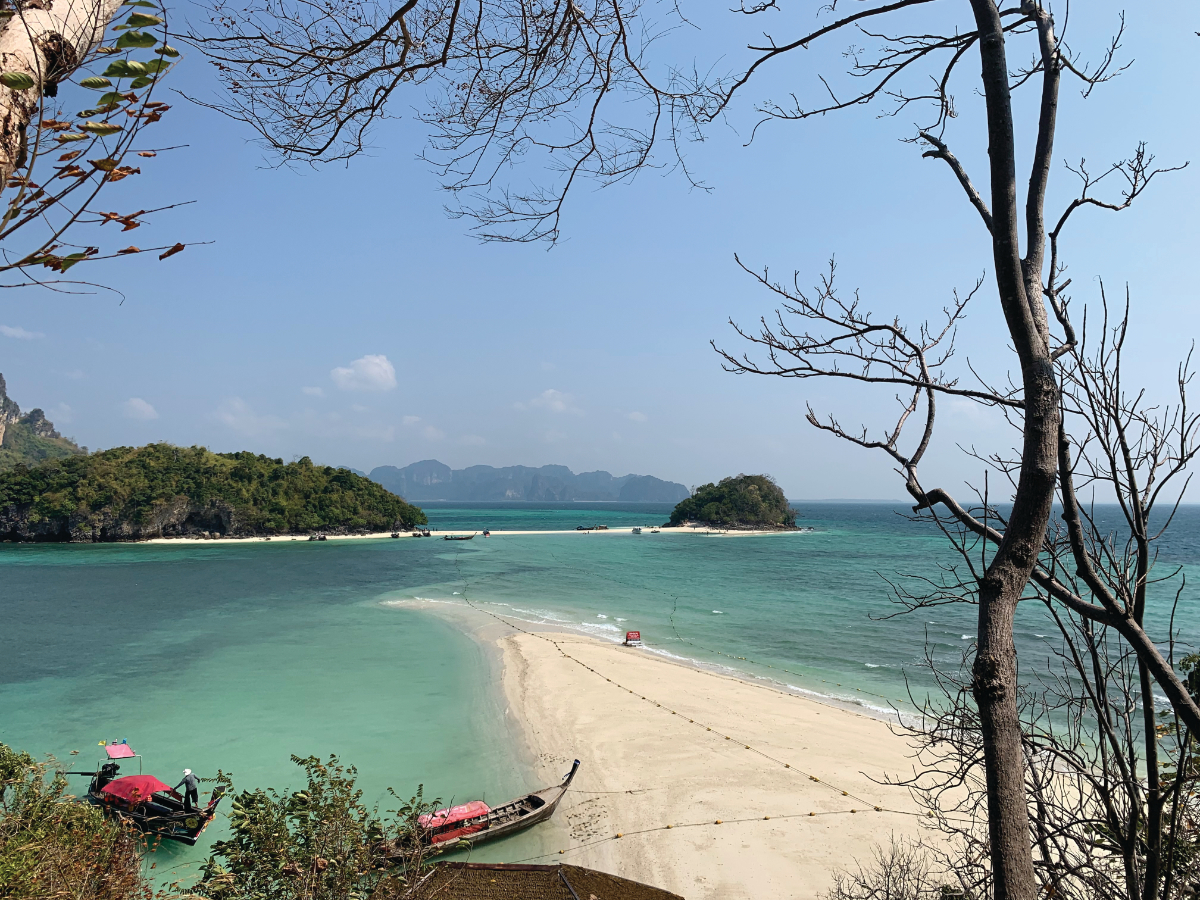
If you’re in the mood for lunch or a refreshing swim, drop anchor at East Koh Dam Hok. Anchor in 5-6 metres on the edge of the sandy beach which projects from the north-eastern tip of the island.
The bottom comes up very rapidly from about 18-20 metres in crystal water, making it easy to find a good anchoring depth. Be sure to leave enough swinging room for an onshore breeze. Do not leave your vessel unattended. There are budget bungalows and a restaurant ashore. You can rent the bungalows year round.
Click to view Thailand gallery.
FacebookLinkedInInstagram5 miles from Ao Nang, Krabi


This beautiful anchorage at Koh Dam Khwan is in about 12 metres. It’s secure for overnight stops in the northeast monsoon season. Tuck in behind the large expanse of coral reef extending from the main island to a group of rocky islets off the island’s north end.
The snorkelling here is superb. You can easily reach the large reef closing the passage between Dam Hok and Dam Khwan by dinghy. National Park Rangers are busy here collecting that 400 baht per person (at the time of writing) going ashore.
Click to view Thailand gallery.
FacebookLinkedInInstagram
5 miles from Ao Nang, Krabi


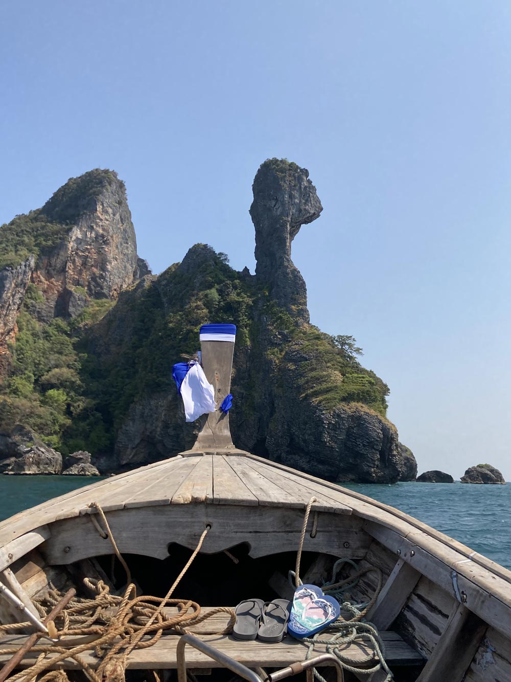
This anchorage is to the southeast of Koh Dam Khwan, just north of the small island. Anchor on a sandy bottom in 10-12 metres of water. This is a secure overnight anchorage in the southwest season. It will be evident from your first sight of the anchorage why this group of islands is known locally as the ‘Chicken Islands’.
Each day tourists pass this area by longtail from Krabi, but anchoring yachts have it to themselves most of the time. Enjoy good diving and snorkelling around both the headland and the island. On the west side of the headland is a small beach with shoals of seargent major fish. Do not feed them! It’s a crime!
Click to view Thailand gallery.
FacebookLinkedInInstagram