This website uses cookies to improve your experience. We believe you'll be OK with this, but you can opt-out if you wish. Or you can go to 'cookie settings' and choose which cookies to allow. Privacy policy

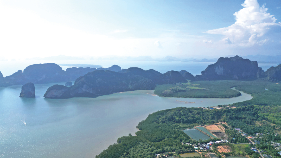
Click to view Phang Nga Bay photo gallery.
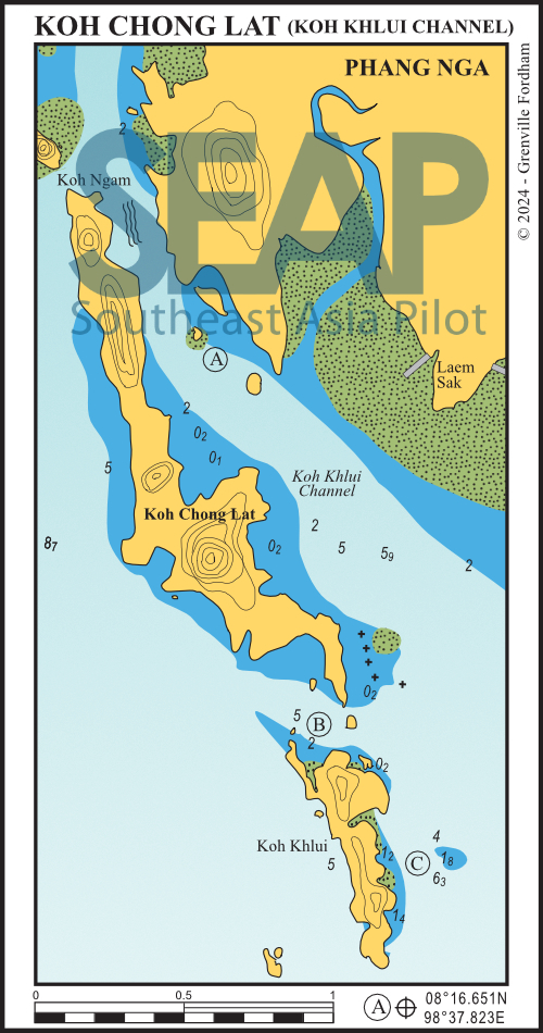
The deep entrance to the north of Koh Chong Lat is easily navigable, as is the middle entrance just north of Koh Khlui. Approach the middle entrance on an easterly heading, turning southeast between the islands.
There is a dangerous area of shallow water with drying rocks inside the main channel between Koh Chong Lat and the mainland. You’ll find it immediately north of the middle passage. You should leave this well to port if heading north.
If entering the main channel from the south, its better to stay close to Koh Khlui. This approach will afford a minimum depth of 3 metres. When entering from the north, pass through the narrow channel between Koh Ngam and Koh Chong Lat. This is deep so better than passing north of Koh Ngam where there is a very large drying bank.

25 miles from Yacht haven


This is a quiet location in the north channel. It enjoys beautiful views of the sheer cliffs of Koh Chong Lat to the west. The chart shows the anchorage is on a direct line between the two islets, in 8-10 metres. It is near a lovely mangrove-covered flat, which is awash at high tide.
This spot is good for all wind conditions. However, mid-tide currents of up to three knots mean that you should take care if swimming from the boat. Local lore has it that there are no longer any crocodiles in the area. Instead, there are families of sea otters which can be spotted at dusk.
To the east on the mainland at Laem Sak village is an excellent seafood restaurant which can be accessed directly by dinghy at high tide or via a concrete jetty on the west side of the headland at the head of the mangrove creek.
24 miles from Yacht haven


The anchorage in the middle passage is in 4-5 metres, making for a good overnight stop in either season. To the north and south, you can easily reach large and scenic bays with shallow waters by dinghy. The bay to the south is an ideal anchorage for bilge keelers or vessels drawing less than one metre.
23 miles from Yacht haven


Koh Khlui East offers very good shelter, with good holding in the southwest monsoon. The best anchorage is just south of the small inlet in about five metres. This is also the best place from which to explore the bay and rocky outcrops to the north by dinghy.
Click to view Thailand photo gallery.
FacebookLinkedInInstagram