This website uses cookies to improve your experience. We believe you'll be OK with this, but you can opt-out if you wish. Or you can go to 'cookie settings' and choose which cookies to allow. Privacy policy
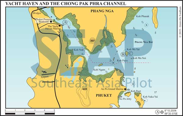
The chart shows the channel created by the northern part of Phuket Island and the mainland province of Phang Nga. At the western end, the main northbound road crosses over two bridges. The centre span of the old bridge has been removed and the new bridges have approximately 12 metres air draft.

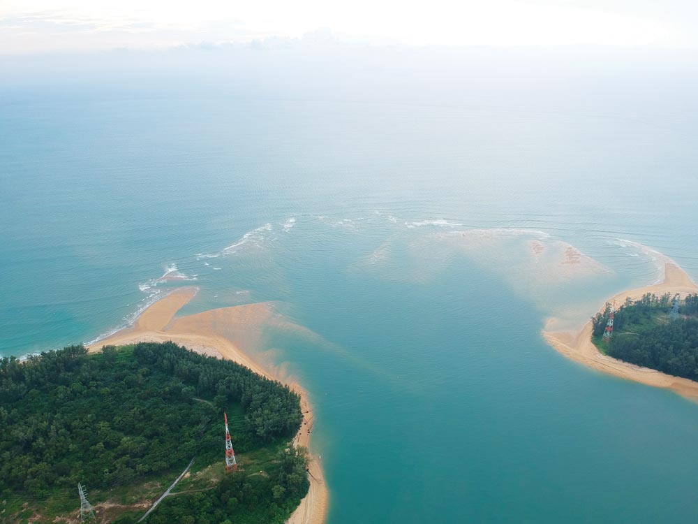
Fishing vessels and large power craft regularly pass this way, but the route is not suitable with fixed masts. The passage out to the Andaman Sea is navigable with care. However the sandbar is constantly moving and we don’t recommend this route without local knowledge.
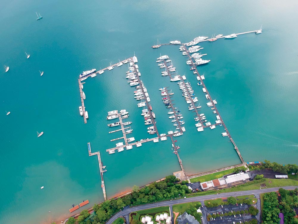
Yacht Haven Marina is located at Laem Phrao east of the bridge at the head of the channel. The international airport is nearby – an advantage for those who berth yachts here and fly in for holidays or weekends.
To find Yacht Haven from Phang Nga Bay, approach from the east into Pak Phra Channel. Approach Koh Ngam on a bearing due west (270°). Leave Koh Payu well to starboard as there are coral outcrops just south of the island. Continue past Koh Ngam keeping it to port. Stay on the same bearing until you see the northern power pylon shown on the chart.
Keep Koh Ngam astern and steer approximately 320° towards the pylon. When the marina is in view a pair of red and green buoys consistent with the IALA system (red: port, green: starboard on entry) guide you into the marina entrance from the north.
The same applies for night time access, except there is a sector light (red, white and green) to assist passage up the channel. Follow the white light (red or green indicates that you are off course). Look out for the red and green buoys at the marina entrance, which are not lit but have reflectors.
Approaching Laem Phrao, beware of shallow water on the port side after passing Koh Nok and the drying sandbanks on the east side of the channel, opposite the marina entrance.

Click to view Phang Nga Bay photo gallery.


This marina has all-tide access and superyacht berthing. Access is from the east on all tides, though deep draft vessels need to take additional care to follow the channel during lows. We recommend you make your first time approach during daylight hours and at high tide. The minimum depth on the approach is 2.5 metres at low tide.
There are 320 berths all with power, water and internet facilities. In addition, the outer dock wave attenuator can cater to 30 superyachts up to 70 metres with drafts up to 5 metres. Minimum depth in the main marina is two metres at LAT.
Facilities include a special work dock for smaller jobs, fresh water and fuel delivery services. +66 (0) 76 206704. VHF Ch. 68.
On shore along the waterfront is the clubhouse bar and restaurant, marina office, dockside service companies and brokers. Showers, lockers, toilet facilities and some rent-a-car, tour and taxi operators are all available.
The Galileo Maritime Academy professional crew school accommodations sits on the top road, together with MCA approved engineering workshops, a survival training pool and advance fire-fighting facilities.
Click to view Thailand photo gallery.

8 miles from Yacht haven


FacebookLinkedInInstagramClick to view Phang Nga Bay photo gallery.
8 miles from Yacht haven


A small island at the entrance to the sound affords good shelter for either season. Anchorage is in approximately 5 metres. The passage between Koh Wa Yai and Koh Wa Noi is narrow but navigable with care.
There is a sandy beach on the northwest point. Hoards of returning sea canoe day tourists commonly visited this beach between 3-5pm.
