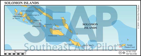
Solomon Islands is a nation state made up of six main islands and over 900 smaller islands, covering 28,400 sq km between latitudes 5°-13°S, and longitudes 155°-69°E. The capital, Honiara, is on the island of Guadalcanal.
A former British protectorate that gained independence in 1978, the Solomon Islands population is predominantly Melanesian and the official language English. However, only a tiny percentage of the population is able to use English fluently, the de facto main language being Solomons Pijin. Nevertheless, there are at least 70 languages and dialects in use throughout the islands.
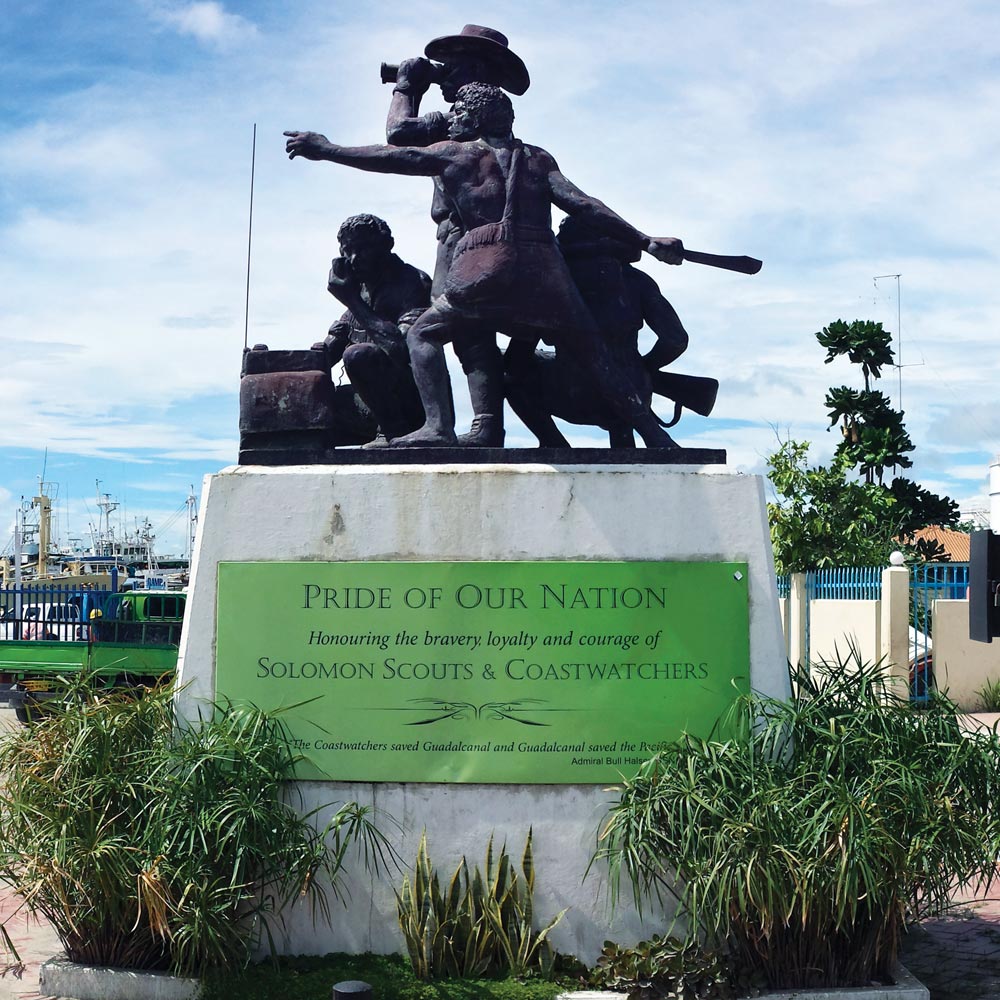
The islands played a significant part in World War II, and the Battle of Guadalcanal has become entrenched in military folklore and has featured in numerous movies.
On another note, Solomon Islands has one of the highest rates in the world of GBV (Gender Based Violence), with 73% of men AND 73% of women considering violence against women justifiable for disobedience…
Honiara is the capital city of Solomon Islands and is an official port of entry. Anchoring or stopping before you clear in at an official port of entry can result in heavy fines. We highly recommend using an agent in Solomon Islands; it’s well worth the extra expense saving you time and the aggravation of navigating the local bureaucracy.
Theft from yachts can be a problem, especially around Honiara and Gizo. Take sensible precautions. However, yachts (and the money they bring to spend in the villages) are generally welcomed and most locals are keen to help if you get into trouble.

>>> Click here for a complete list of anchorages in Southeast Asia Pilot.
375 miles from Honiara


The town, Lata, is located on the northern side of Nendo, the largest of the islands in the Santa Cruz group.
For clearing formalities, Lata has Customs and Quarantine, but you’ll have to do Immigration in Honiara on Guadalcanal. Once formalities are complete in Lata, report to the police, who should notify Immigration in Honiara that you’ll be heading their way.
For cruisers coming from Vanuatu, Nendo is a necessary stop if you want to visit islands before you reach Honiara.
Anchor at the bottom of the bay in 20 metres good holding in mud and take your tender into town. The dock near the town is in disrepair; be wary of tying up to it.
180 miles from Honiara


One of the most pleasant islands and anchorages in the Solomons. Charts for this anchorage are often inaccurate, so use caution when entering and do so only in daylight.
In 2017 there was a green lateral mark on the starboard side of the channel marking a reef. Once past the mark, proceed to the anchorage. Anchor in 40 metres. For smaller vessels with less chain proceed with caution from our anchorage on course 120°till you are in shallower water, just 20 metres off the village. Or ask a local to point out the best place to anchor.
The Solomon islanders are renowned for their wood carvings and the islanders of Santa Ana are no exception. There are some great local artisans who will canoe their wares right out to your boat so that you can buy for cash or trade.
When travelling to the Solomons, remember that the locals are always looking for tools, so a couple of spare tool sets make great items to trade with.


Anchoring: Our main Honiara anchorage (J) is a straightforward approach to anchor in 9-11 metres. Holding is poor, so use plenty of scope and watch for shifting winds.
The alternative anchorage, 9°25.675S, 159°57.300E, about half a mile ESE, is only recommended for yachts under 20 metres. Two buoys mark the entrance to the channel; stay to the middle and watch for local traffic at night. Fair holding in 6 metres. There’s one courtesy mooring here maintained by the yacht club.
When going ashore, the two best options are the Point Cruz Yacht Club and a small restaurant to the west of the yacht club. There’s a sunken craft near this dock marked by a small buoy; use caution when entering.
When anchored off Honiara it’s wise never to leave your vessel unattended. Maintain a vigilant watch against theft, especially at night – locking up any loose gear and tenders. If you have to leave your vessel unattended, a local watchman can be employed for a reasonable fee. This is best arranged by an agent.
There are several commercial piers if you need to arrange fuel or want to take on provisions.
84 miles from Honiara


Approximately 80 miles from Honiara, and 20 miles from the Russell Islands (Pavvuvu Is.), this extinct volcano (also known as Mary Island) is covered in jungle and uninhabited.
It’s popular with local dive boats who maintain mooring buoys and groundlines. The buoys are just under the surface, so take care when approaching. Anchor in 15 metres and throw a line onto a tree or use one of the ground lines. A great spot for fishing, snorkelling and diving. It’s billed as a great place to see barracuda, sharks and big bumphead parrot fish.
215 miles from Honiara


Gizo (Ghizo) is the capital of the western provinces of Solomon Islands. The main port of Gizo is an official port of entry, has several good anchorages, docks and is relatively easy to navigate.
It’s actually a tiny archipelago with many great anchorages. One of the more noteworthy is just off of Mbambanga and south of Kennedy Island 8°7.556S, 156°54.356E. Kennedy Island is named after US President John F. Kennedy.
Kennedy was stationed in the Solomons during WWII as captain of PT109 torpedo boat. On a dark night Kennedy’s boat was struck by a Japanese destroyer and sunk. He swam to the tiny island (Kasolo Is) towing an injured shipmate with him. Today there’s a small bar surrounded by memorabilia from the war.
