13 miles from Sam’s


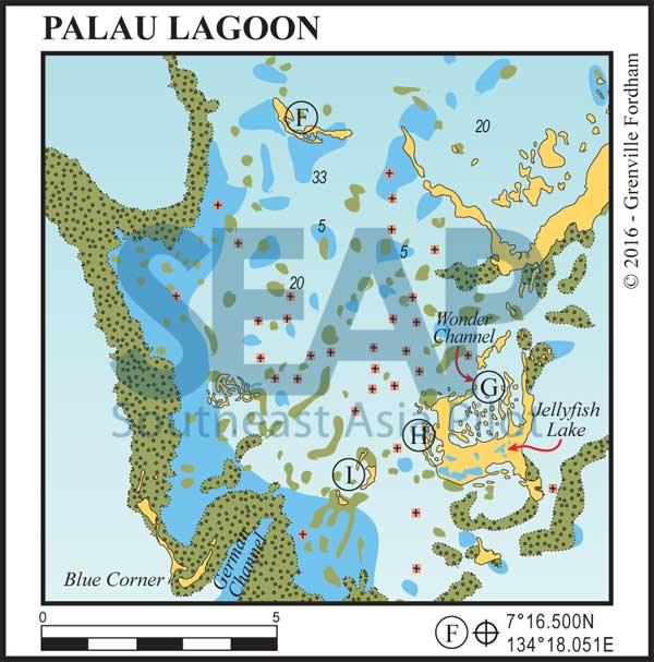
Rattakadokoru or Ulong Island is an excellent central lagoon stopover anchorage. Shelter can be found in most conditions at various spots around this crescent-shaped island.
A smaller yacht can get tucked in very close to the landmass for excellent shelter. Larger vessels should drop anchor in the north bay in 15- 20 metres. Anchoring here gives close access to the Ulong Channel, one of the top-rated dive sites in all Palau.
21 miles from Sam’s


Anchor anywhere with safe swinging room in 15-24 metres on sand. The Wonder Channel is the cul-de-sac in north of Eil Malk or The Mercherchar Island group. It’s another great spot to hang out, especially in foul weather.
Many of the liveaboard dive operators have their most trusted moorings inside here. This is the same group of islands as the Jellyfish Lake tourists are allowed to visit, so to anchor here cuts your travel time to visit this amazing spot.
This island is part of the Rock Islands group, which are mostly uninhabited, in Palau’s Southern Lagoon between Koror and Peleliu.
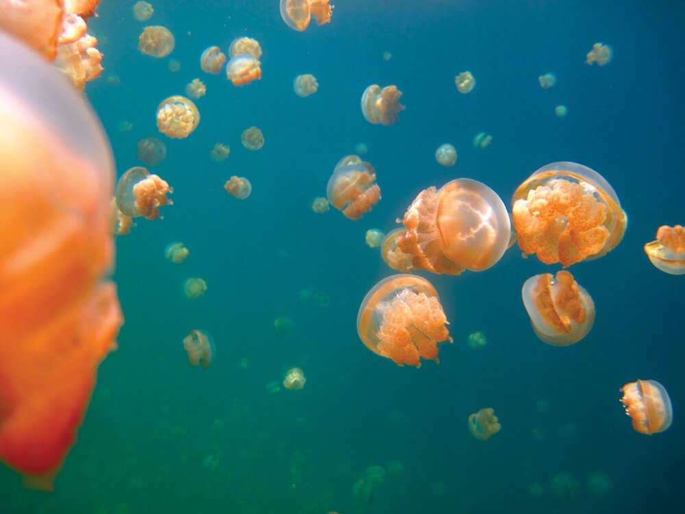
Millions of non-stinging golden jellyfish migrate across the lake daily following the sun. This is because they derive part of their nutrition from symbiotic algae (Zooxanthellae) that live in their tissues and require direct sunlight to become food for the jellyfish. The isolated lake was formed some 12,000 years ago trapping them inside to evolve and adapt in a no-food environment, although the lake is oxygenated and renewed by the tide through subterranean limestone fissures and tunnels connected to the ocean outside.
Snorkelling is a popular activity for Palau tourists and several operators in Koror offer daily trips to the lake. It is a 45-minute speedboat ride from Koror followed by a 10-minute walk from the jetty access up and over a jungle hill.
Scuba diving is forbidden because bubbles can harm the fragile jellies and the anoxic layer begins at around 15 metres, with high concentrations of deadly hydrogen sulphide, which can be absorbed through the skin. Although there are more than 50 lakes in the Rock Islands, Jellyfish Lake is the only one currently open to tourists.

24 miles from Sam’s


Anchor in 12-22 metres on sand outside the cove. This is one of the favourite spots of this pioneer of superyachting in the region. Captain David likes it here because it’s sheltered and quiet, while still nice and close to the south of the lagoon where some of the regions most spectacular dive sites are on offer.
This peaceful anchorage is well off the track of most of the local dive operators running to and from Koror. It’s only a few miles out to the awesome drift dives of ‘German Channel’ where the manta’s play. A little further to the outer reef opening to ‘Blue Hole’ leading to a cave dive called ‘The Temple of Doom’ and the superb drift diving and vertical drop-offs of ‘Blue Corner’ – all at Palau’s extreme western edge.
26 miles from Sam’s


In the very south end of the main lagoon, and even closer to the dive sites, there are a few nice spots depending on the prevailing conditions.
The noted GPS position is inside a group of islands popular with dive operators for their decompression interval, lunch break, stop. It’s known as Two Dogs Beach or Long Beach. At low tides there are a couple of beautiful sandy beaches. Why, do you ask, Two Dogs?
